
Oh My Darling (Long Lake) (120km)
- RideGravel.ca

- Oct 21, 2019
- 3 min read
Updated: Feb 11, 2022
Location: Lanark, Lanark County, Ontario
Estimated Gravel Time: 95%
Full Route Map:
Distance: 120.1km (74.6 miles)
Suggested Tire Width: 40mm minimum, with the understanding that you'll be somewhat underbiked for the hydroline cuts.
Amenities: The village of Lanark has a general store, chip stand, and pizzeria. There are no other amenities on route.
Parking: Lanark Community Centre, Lanark (although plenty of on-street parking in town),
Route Description
This long day ride or weekend bikepacking loop is 95% dirt, taking advantage of the loads of unmaintained roads, hydro cuts and Crown Land north of the village of Lanark. The route passes four Crown Land campsites (with more possible along the various ATV side trails that litter the north end of the loop). Tire selection is key here – while most of the route could be ridden on 35mm, the hydro cuts require something beefier. The minimum suggested width is 40mm, provided you are comfortable being significantly underbiked on certain sections. Tires between 2.1 to 3.0 inches wide would be better suited for the hydro cuts, with the understanding you’ll be somewhat overbiked on the rest of the route.

Starting from the village of Lanark, ride counterclockwise on Rosetta Rd. via an extended section of gravel that includes Mitchell Rd. and Concession Rd 6C to the pretty hamlet of Middleville. From here, head north a quiet section of pavement (Galbraith Rd.), before turning left onto Darling Rd. for approximately 18km.

Darling Rd. is often viewed as simply a means to reach California Rd. - this shortchanges how great this section of the route is. It is a fantastic stretch of gravel with plenty of climbing, which eventually transitions to unmaintained single lane dirt. Riders can continue following Darling all the way to the hydro cut. But the route takes a slight detour to explore some Lanark County Conservation Forest access trails, before rejoining Darling Rd. and turning left onto the first hydro cut of the route.


This section of the route is a mix of rocky doubletrack, sand, and shallow standing water. Eventually, the route leaves the hydro cut, heading north along some tree-lined double track all the way to Darling Long Lake. You could get away with 40mm wide tires here – although this will depend on your level of comfort at being underbiked.
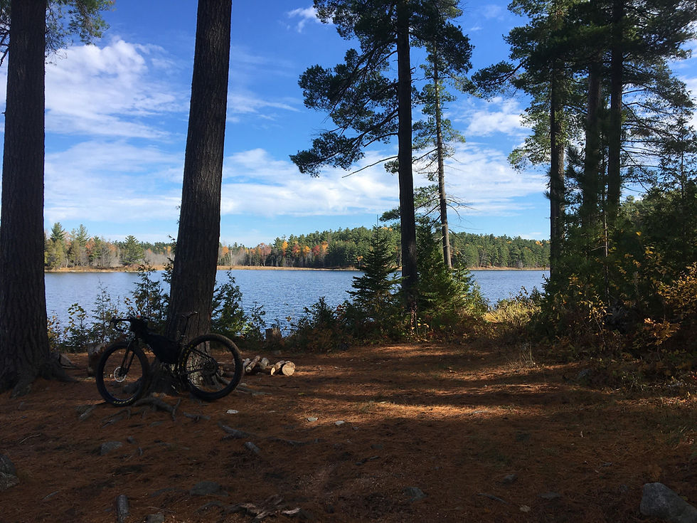
The first campsite can be found slightly off route on the south-west shore of Darling Long Lake. Riders choosing to forgo this first site can continue on the loop along a smooth and flowy section of gravel doubletrack all the way to Provincial Highway 511.

From here, riders can follow the highway briefly for a couple of kilometers all the way to Campbells Rd. However, riders may also choose to continue straight across the 511 to Little Green Rd., following a series of ATV trails which ought to eventually connect to Campbells Rd.

Campbells Rd. is another extended stretch of unmaintained, climbing for the most part in the beginning before descending rapidly to Joes Lake. From here, riders can access two more Crown Land campsites. The first (and best) is on the south shore of Green Lake, off French Line Rd. The second (smaller) site is further south on the north shore of Joes Lake, along Flower Station Rd. Riders looking to avoid the second hydro cut would be advised to continue via Flower Station Rd., followed by a left on Clyde Forks Rd. to the K&P Trail.


Riders choosing to continue on route will hit the second (and most difficult) section of hydro cut from Black Creek Rd. to the K&P Trail. Anyone riding on 40mm tires or less ought to be supremely confident in their bike handling skills. Anticipate rocky terrain, sand, and standing water, with several sections of hike-a-bike thrown in. The views are spectacular (and well-earned).

The hydro cut eventually exits onto the K&P Trail. Turn left and follow the rail trail to South Lavant Rd., a 6.5km section of hilly pavement, before eventually turning right onto Lavant Mill Rd, which in turn transitions to unmaintained. Eventually, riders turn left onto Ranger Camp Rd. (where several campsites can be found off the south shores of Upper Park Lake and Woods Lake), and Umphersons Mill Rd. South.


The loop eventually turns right onto the 2nd Concession, and follows a series of gravel country roads all the way back to Lanark.


I rode a modified version of this in September 2024. The hydro line section from the 63 to 73 km section gradually became worse and more overgrown going further south, including significant beaverdam flooding. ATV's could not longer make it through so it was barely used at the south end. I bailed out a private driveway to the K&P after some struggling on my XC bike. Just take the K&P from Flower Station Road
Just a piece of useful information in case you take the longer but flatter route via Flower Station rd, Clyde Forks. rd is closed until mid October 2023, You can take a longer detour by continuing into Flower Station and turning onto the K&P trail there