
Haliburton Highlands Half ‘n Half (53km)
- Apr 22, 2020
- 2 min read
Updated: Feb 9, 2022
Route Author: John Swarbrick
Location: Haliburton, Municipality of Dysart et al, Haliburton County, Ontario
Estimated Gravel Time: 50%
Full Route Map:
Distance: 52.6 km (32.7 miles)
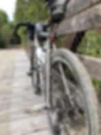
Suggested Tire Width: 38mm or wider
Amenities: The starting point in the town of Haliburton has several convenience stores, restaurants/pubs and breweries. The hamlet of Donald, off of the Haliburton County Rail Trail, has a small bakery. There are no other amenities on route
Parking: The town of Haliburton has ample on-street parking available. Dedicated parking facilities can also be found at the AJ LaRue Community Centre.
Route Description:
This 52.6 km backroads ramble submitted by John Swarbrick includes a 50% mix of gravel/rail trail and 50% quiet paved cottage roads.
Beginning from Haliburton, riders head clockwise, leaving the town behind on the Haliburton County Rail Trail. The route follows the rail trail south for approximately 13km and is a nice way to avoid travelling on Gelert Rd., which parallels the trail. But don’t let the term “rail trail” fool you. This portion of the route includes several sandy and choppy section, hence the route’s minimum suggested tire width of 38mm. Riders looking to satisfy their sweet tooth would also be advised to stop by the Little Tart Bakery in the hamlet of Donald, a real gem in the area!
Upon reaching Ritchie Falls Rd., the route leaves the rail trail behind, in favour of some quiet country pavement via Lochlin Rd. Eventually, the route hangs a left onto Tom Bolton Rd before making another left onto County Rd 18. After a scenic tour of the southern end of Kashagawigamog Lake, riders make a brief right onto County Rd 21 (a busier road that’s blessed with a paved shoulder), followed by a left onto Bethel Rd., continuing on quiet pavement for just over 4km before reaching the intersection with Duck Lake Rd.

Here, riders make a right and continue north on this quiet cottage road for another 7km or so, before making a right onto Blairhampton Rd. and returning to gravel via Soyers Lake Rd.Upon reaching the road’s namesake, the route returns to asphalt and hugs the north end of the lake, eventually intersecting with Country Rd. 21.Here, the route makes a left, followed by a quick right onto Wonderland Rd. as the loop once again kisses the eastern shore of Kashagawigamog Lake, before re-joining County Rd 21 as riders continue on the paved shoulder all the way back to the starting point in Haliburton.