
Lowest of the Low (Full Cycle Edition)
- RideGravel.ca
- Sep 20, 2019
- 3 min read
Updated: Mar 21
Location: Low, Vallee-de-la-Gatineau, Quebec
Estimated Gravel Time: 85%
Full Route Map:
Distance: 94.9km (Full Route)
Alternate Route (73.2km): The “classic” version of the Lowest of the Low avoids much of the additional mileage south of Low, including the climb over the Paugan Dam. Download GPX File
Suggested Tire Width: 35mm or greater
Amenities: The starting point in the village of Low has a gas station, convenience store and a small restaurant. The hamlet of Lascelles, just over 19km south of Low has a well-stocked general store. Finally, the village of Danford Lake at the top end of the loop features a small depanneur with all the essentials.
Parking: A number of parking options can be found along the route, with several in Low itself including the Kiosque touristique de la MRCVG à Low; the Gatineau Arena; and just north of town at the Halte Routière Low.
Looking for options to shorten the route? Off-street parking can also be found near the centre of the loop in the hamlet of Fieldville next to the cemetery, across the street from the church. Finally, the northern end of the loop offers ample parking at either Henry Heeney Memorial Park or Volunteer’s Park Memorial.
Route Description
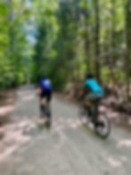
Featuring 85% dirt roads, a mix of gentle and steep climbs, and even some sections of unmaintained, this route bears all the hallmarks of a classic southwestern Quebec gravel loop!

Starting from the Gatineau Arena and riding clockwise, head east along Chemin Principale as it transitions to Chemin Paugan and climbs steadily to the top of the dam. Take in the views while keeping an eye for oncoming traffic (be courteous as the road over the dam is a single lane), then descend from the dam to the intersection with Chemin de Farellton. From here make a right and head south, paralleling the Gatineau River before eventually traversing the truss bridge to Route 105.

Utmost care ought to be taken when crossing the 105, as traffic can be heavy at times with vehicles moving at a high rate of speed. Travel south along this short 1km stretch of the 105, taking care to stay to the right, before reaching Chemin Woods. Here, riders will climb steadily out of the river valley, travelling west for approximately 6km before reaching the general store in Lascelle.

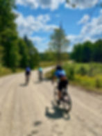
The loop then heads north, staying on a series of dirt roads as the route winds its way almost 6km to the outskirts of Fieldville, before making a left and following Chemin Fieldville. This gorgeous section of treelined gravel eventually transitions to Chemin Cawood Est, before turning right to become Chemin Cawood, which riders follow all the way to the village of Danford Lake.


At the approximate 2/3rd mark, Danford Lake with its convenience store and several parks and picnic areas, makes for an ideal rest stop. From here, continue on a short stretch of Route 301, being mindful to stay as far to the right as possible due to the potential for high-speed traffic, until the route shifts back to gravel via Chemin Jingletown. This leads to one of the nicest sections of unmaintained in the area (Chemin Wiggins). This section is not technical whatsoever and can be ridden on 32mm tires with a bit of finesse.
Shortly after Wiggins, riders follow a mix of gravel and pavement along Chemin Burrough. Thereafter, riders turn onto Chemin du Lac Pike, following a lovely stretch of dirt to the site of the former covered bridge across Stag Creek. Sadly, this iconic landmark was destroyed by arsonists in January 2019. While the current bridge lacks the original's historic charm, rest assured that the soul-destroying climb following the bridge lingers on. From here, only 2km remains before reaching the hamlet of Fieldville.
Make a left and continue on Chemin Fieldville as the route snakes its way for 6km on a mix of pavement and gravel. Riders will have to carefully negotiate several steep descents and narrow bridge crossings before arriving at the Véloroute des Draveurs. Make a right here and briefly follow the rail trail back to Low and the end of the loop.